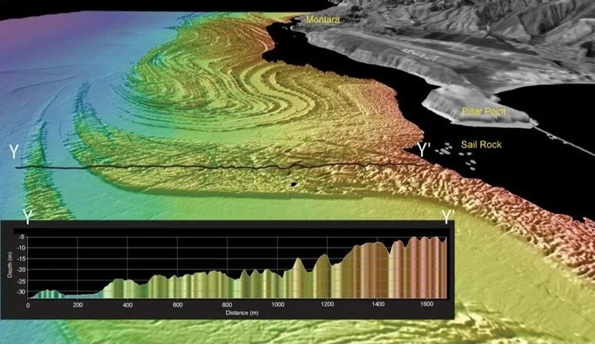
Bathymetry
the measurement of depths in oceans, seas, or lakes.
Why do we need bathymetry?
The study and measurement of underwater topography is crucial for several reasons:
Navigation and Safety: It helps ships, submarines, and other vessels avoid underwater hazards like reefs, submerged rocks, and shallow waters. Navigational charts rely heavily on bathymetric maps to ensure safe routes for maritime traffic.
Marine Infrastructure: Bathymetry is essential for the planning and construction of underwater structures such as pipelines, wind farms, cables, and bridges.
Environmental Studies: Bathymetric data plays a key role in understanding marine ecosystems, including habitats for various species. It helps scientists study the impacts of environmental changes, such as sea-level rise, climate change, and human activities like dredging and coastal development.
Geological Research: Bathymetry is used to study the Earth's geology, including plate tectonics, underwater volcanoes, and ocean floor spreading.
Resource Management: Bathymetric data is essential for managing ocean resources, such as fisheries and minerals.
Tsunami and Hazard Prediction: Knowing the bathymetry of an area helps in predicting the behaviour of tsunamis and understanding how underwater earthquakes and volcanic eruptions might affect coastal regions.
Climate Change Research: Bathymetric data helps assess the impact of climate change on the ocean floor and coastal areas, particularly regarding sea-level rise, coastal erosion, and the effects of melting ice caps on ocean circulation patterns.
History
Historically, prior to sonar, sailors would cast heavy objects on the end of a line into the water, counting the fathoms through their hands. This was known as ‘lead-lining’. Similarly, another physical method was used to determine depths of isolated features such as rocks or wrecks, called ‘wire-sweeping’, whereby, two vessels were utilised, iteratively towing a weighted line between the two at a set depth. If the line snagged the submerged object, a bell would ring signalling the depth it is still present.
Survey
Unlike the relative ease of mapping land, the oceans are unforgiving & down-right difficult environments to measure. We use the reflection of sound waves to determine the ocean’s depths, with high resolution measurements now possible thanks to advancements in sonar technology.
Sound velocity
We use acoustic waves to detect the seabed, due to the ability of sound to travel large distances subsea, faster & deeper than light. In order to do so, we need to accurately know the sound velocity profile of the water body in question. Due to temperature, salinity & pressure differences throughout the water column, it is imperative to measure this profile at the time of survey. This allows the sonar to account for these variations accordingly.
Sonar
In the early 20th century, Sonar (sound navigation & ranging) was developed in order to more efficiently and accurately sense the seafloor. Essentially, if the velocity of sound through water is known, we can determine the depth below the transducer by measuring the reflection time of a sound wave.
Sonar has since been developed and refined into more advanced sensors. With the help of accurate satellite positioning systems and motion sensors, we are now able to utilise several hundred sonar elements at once, many times a second, to effectively scan swathes of seabed.
Art
Now, with modern technology enabling the mapping of seafloor features in great detail, I believe these wondrous findings can be presented in an artistic light. I hope others can find the same enjoyment I take from gazing at the unveiled world below.


